
Q&A: Life as a GIS Intern


Some of us, it seems, have been “doing spatial” since dinosaurs roamed the earth. We measured great circle arcs in cubits… colored thematic maps on cave walls with hand-ground pigments, annotating them with a pointy charred stick… and walked uphill to the office both ways. Really. I wouldn’t make this stuff up.
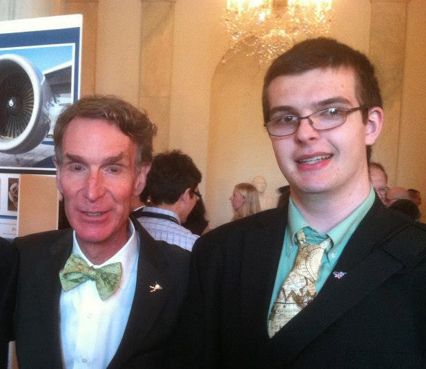
So when we stumbled upon David Runneals’ “A Summer at Iowa DOT” on his personal blog, in which he spent the summer of 2014 as an intern with FME innovator Eric Abrams and his team (of Plowcam fame), it seemed the perfect opportunity to reach out and see what it’s like for the new generation of spatial experts as they enter the field.
Where did your interest in GIS start?
Well, when I was in high school I attended a GIS Day event in Iowa, and met a 4-H leader that was working on a years-long cemetery mapping project. The geospatial aspect – the “where” to everything – really appealed to me. Then the 4-H club I was involved in received an Esri grant, and that led to being on the 2009 National 4-H GIS/GPS leadership team, and it’s just grown from there.
So 4-H isn’t just about the rural life anymore.
I’m more an urban-type member – lived in town, never showed any animals! 4-H is getting really innovative. My club was on the technical side, with robotics and mapping. In my senior year in high school, we built a 120-pound robot for FIRST Robotics Competition. I’m still involved as a mentor for my brother’s FIRST Tech Challenge Team. At the 2013 National 4-H Conference, my roundtable was on citizenship science, and I got to present to the White House Office of Science and Technology Policy at the White House, and even attend the White House Science Fair with the National 4-H STEM Director. It was amazing.
It sounds like you’ve turned your passion into a career path – and one of the first stops was your internship this past summer with the Iowa Department of Transportation. What was that experience like?
I really liked seeing my work impact the real world, compared to theoretical course work. They gave me a number of projects, like developing standards for their ArcGIS Online site and deploying multiple ArcGIS Server upgrades – and on that one, I came up with some architecture redesign ideas for server configurations that made the process smoother, and those ideas were adopted and rolled out. The experience really solidified for me what sort of work I find challenging and enjoyable. Managing projects, building data infrastructure – that keeps me interested, more so than the analytical and making maps end of GIS. Now I’ve added Management Information Systems as a complementary major, and it’s a direct result of my experience here.
Was this your first encounter with FME?
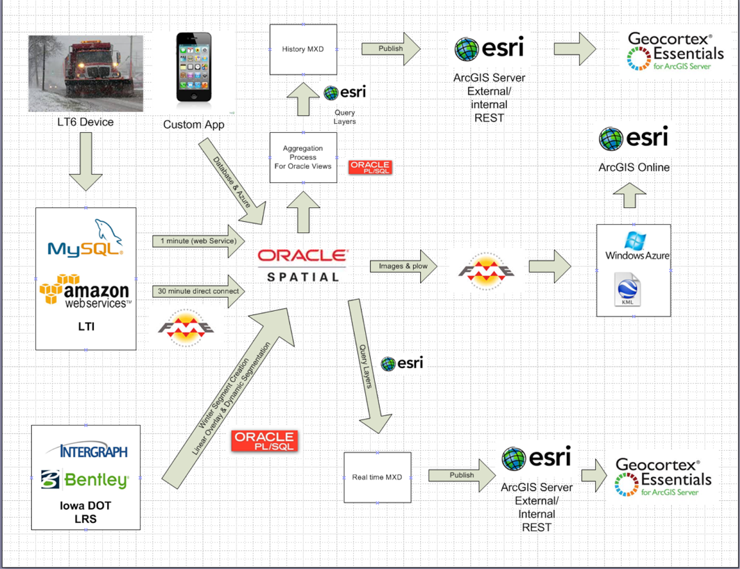
Yes, it was. Eric introduced it to me, let me play around with it a bit, and then showed me his snowplow process. I started experimenting with FME Server and trying to add new pan-tilt-zoom cameras automatically. I really got into it with the 511 system, where we were integrating with the Traffic Operations section, mashing up KML from all sorts of different sources.
It was a bit daunting at first, figuring out what I could do with it and which transformers to use, but once I got accustomed to it, it was a pretty fast learning process. I think one of the most powerful aspects I discovered was manipulating XML using xfmaps – a lot of our data and data from neighboring states is provided as XML or RSS-type feeds. There are other ways to approach XML with FME, I know, but this method appealed to the programmer in me. It’s really flexible.

Do you have any advice for other students?
I’d encourage them to get GIS experience. Even if you’re not majoring in it, there are so many opportunities that cross over from other fields into GIS. When I was searching, I came across internships from clothing companies, Starbucks, and almost every imaginable government entity, all using GIS along with business analytics. I think there will always be opportunities for GIS people, but supplementing your skills will open up your choices a lot.
And there are different aspects to a career in GIS – I was lucky to find out early that my interests lie in the architecture and management behind the GIS. I’d much rather be developing the products than using them, and since experiencing that in the real world with this internship, I am making choices about my education that will really prepare me well for this career.
David is a sophomore at Northwest Missouri State University in Missouri, pursuing a Bachelor of Science, majoring in Management Information Systems, Emergency and Disaster Management, and Geographic Information Sciences.
And after his summer at Iowa DOT, he’s now an FME fan too.
You can read his blog at david.runneals.com
And if you’re wondering why everybody seems to be loving XML these days, check out Don’s blog post: 7 Reasons to Love XML and its ‘Baby Brother’ JSON
Explore more blog content headline

Data-Driven Marine Operations: 5 Ways to Generate Actionable Insights from Ship to Shore


Introducing FME Form 24.0: Redesigned User Experience for Focus and Consistency


[New!] AI Assist in FME: How to Build Better Data Integration Workflows with the Help of AI